Volcán Lastarria was a milestone for Trail by Fire because it marked the end of our travels in the Andean Central Volcanic Zone, the belt of active volcanoes that runs through southern Peru and northern Chile. Ahead of us, we had the long drive south across the Pampean Gap to reach our next target volcano. This gap reveals something fundamental about how volcanoes in the Andes work, and why we’re here in the first place, but it requires a bit of explanation…
To recap the geological story so far, volcanic activity in the Andes is caused by the Nazca plate (which is under the Pacific Ocean) sliding beneath South America along the Atacama Trench. Water and gasses, which we call volatiles, are liberated by the increasing heat and pressure as the plate sinks. These volatiles rise into the overlying mantle and change its chemical composition, causing it to melt, which creates magma. This mixture of molten rock and volatiles rises to the surface, where we hope to capture some of the gas in our MultiGas or Delta Ray to reveal its provenance. Of course if the gas escapes our clutches we can still catch it in a quadcopter mounted flying Tedlar bag, or image it with our UV cameras and Flame spectrometers (all of these would be deployed on Lastarria, but more on that later). However, a few volcanoes south of Lastarria something strange happens; this titanic chain of volcanism that we’ve been following these past two months through Peru and Chile... stops.
This is thought to be the result of the Nazca plate sinking at a low angle, perhaps due to the collision of a chain of old volcanoes on the plate known as the Juan Fernandez Ridge with the Atacama Trench. As a result, the plate never sinks deep enough to liberate the volatiles, causing a dearth of volcanism for several hundred kilometers before the sinking plate steepens again and volcanism reappears in the Southern Volcanic Zone. This illustrates how important the recycling of volatiles through subduction systems is – it controls where the volcanoes are. You could say the passage of volatiles leaves a ‘trail of fire’ through the Earth’s crust, which would make a great name for a grant proposal. How much gas is there? What pathways does it take? What is its composition? Ultimately that’s what we’re here to find out, and the answer lies at the end of our journey. But before swapping the waterless Atacama Desert for the magmaless Pampean Gap we had one last stop to stock up on volcanological excitement; the enigmatic Volcán Lastarria.
Lastarria lies at the end of a long winding 4x4 track on the border with Argentina, past vast salars and soaring mountain ranges, which our Mobile Volcano Observatory navigated with ease.
We set up camp at the foot of the volcano, and were soon buffeted by the strong evening winds roaring down the mountains at sunset, and then frozen by plummeting temperatures at night. But our tent, courtesy of Land Rover Special Vehicle Operations, stood firm and kept us cosy, and we were rewarded by a perfect view of the milky way through crystal clear skies, and the silence of the deep desert disturbed only by the soft whistling of the midnight winds. We saw no-one in this remote spot, and found only the old tracks of vicuñas and llamas in the desert sands. The next morning we faced a long hot day sampling fumaroles spitting boiling water and corrosive gasses. It was Supertrousers time.
Volcán Lastarria is a stratovolcano that rises to 5700 m above sea level and is famous for its billowing fumaroles and epic sulfur flows that run to hundreds of meters in length. Despite lacking historically documented eruptions, young looking deposits and a history of ground deformation show the volcano is an important target for study. As at Tacora, there is a winding track that snakes through the fumarole fields halfway up the mountain as a legacy of the mining industry, this time copper exploration. This allowed us to take the trail straight to the fire.
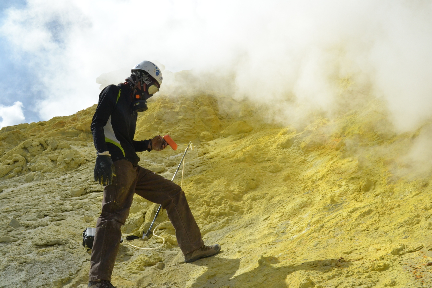
The team deployed the full spectrum of instruments at Lastarria – MultiGas gas boxes to give ratios between different gases, UV cameras and Flame spectrometers to convert these to fluxes, and the DeltaRay to give the isotopic compositions, while Aaron, wiser than the rest of us, kept an eye on us from the air. The thick condensed plumes reduced visibility, while the corrosive acid gasses necessitated the use of gas masks. Breathing the thin mountain air against the resistance of the gas filters was a real challenge, and progress was slow and laborious. But by the end of two days, we had the suite of measurements we needed.
We bade a sad farewell to Lastarria, the beautiful mountain deserts of northern Chile and southern Peru, the Central Volcanic Zone, and all our friends, both new and old, we had met along the way. Before us lies the long drive south across the Pampean Gap to the lands of lush green fields, fjords and the promise of the Southern Volcanic Zone, where the active lava lake of Villarrica, the colossal dome of Chaiten, and the rumblings of Chillán await….


